新書推薦:

《
这就是心理咨询:全球心理咨询师都在用的45项技术(第3版)
》
售價:NT$
717.0

《
正说清朝十二帝(修订珍藏版)
》
售價:NT$
493.0

《
黑海史:从历史涟漪到时代巨浪
》
售價:NT$
538.0

《
我,毕加索
》
售價:NT$
280.0

《
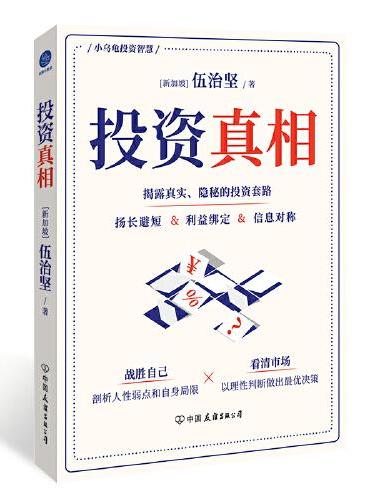
投资真相
》
售價:NT$
381.0

《
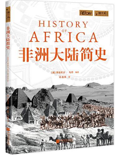
非洲大陆简史(萤火虫书系)
》
售價:NT$
437.0

《
知宋·宋代之军事
》
售價:NT$
442.0

《
我能帮上什么忙?——一位资深精神科医生的现场医疗记录(万镜·现象)
》
售價:NT$
381.0
|
| 關於作者: |
柴华彬,男,1977年8月生,博士后,河南理工副教授,研究生导师,河南省青年骨干教师。主要从事测绘、开采沉陷方面的教学与科研工作。为研究生和本科生讲授了《GIS原理与应用》、《地理信息技术》、《测绘专业英语》、《矿山测量学》等课程。
主持和参与省教育规划课题2项,省厅级教改课题2项。2011年获河南省教育科学研究优秀成果二等奖1项,发表教育教学研究论文7篇。2006年获得省级精品课程1门,2009年获得国家级精品课程1门。作为主要成员,2007年获得《测绘工程》教育部高等学校特色专业,2008年获得测绘工程河南省实验教学示范中心工作,2011年获得测绘工程省级教学团队。
主持和参与完成国家自然科学基金3项,省厅级项目9项,横向技术服务课题18项,获得河南省科技进步二等奖1项,教育部高校科技奖1项,中国煤炭工业协会科学技术二等奖2项,三等奖1项。发表学术论文70多篇,其中EI收录16篇,ISTP收录5篇。出版专著1部,规划教材5部。
|
| 目錄:
|
Chapter 1 Overviews
1.1 Introduction
1.2 Branches of surveying
1.2.1 Geodetic surveying
1.2.2 Plane surveying
1.2.3 Topographic surveying
1.2.4 Engineering surveying
1.2.5 Cadastral surveying
1.2.6 Hydrographic surveying
1.2.7 Mine surveying
1.3 Developments of surveying
1.3.1 Surveying techniques
1.3.2 Surveying equipments
1.3.3 Origin of Geomatics
1.4 Achievements of China''s surveying
Chapter 2 Datums of Surveying
2.1 Introduction
2.2 Geoid and reference ellipsoid
2.2.1 Mean Sea Level and Geoid
2.2.2 Reference ellipsoid
2.3 Map projections
2.3.1 Three kinds of projections
2.3.2 Typical map projections
2.4 Datums and coordinate system
2.4.1 Horizontal and vertical datums
2.4.2 Coordinate systems
2.4.3 Coordinate conversions
Chapter 3 Distance Measurement
3.1 Introduction
3.2 Taping
3.3 Tacheometry
3.4 EDM measurement
Chapter 4 Elevation Measurement
4.1 Introduction
4.2 Leveling instruments
4.2.1 Ordinary level
4.2.2 Automatic level
4.2.3 Digital level
4.2.4 Laser level
4.3 Spirit leveling work
4.3.1 Principle of spirit leveling
4.3.2 Methods of spirit leveling
4.3.3 Refraction and curvature
4.4 Trigonometrie leveling
4.4.1 Instruments of trigonometric leveling
4.4.2 Principle of trigonometric leveling
4.4.3 Methods of trigonometric leveling
Chapter 5 Angle Measurement
5.1 Introduction
5.1.1 Horizontal angle
5.1.2 Vertical angle
5.2 Direetion and azimuth
5.2.1 Direction of line
5.2.2 Azimuth and bearing
5.3 Theodolite
5.3.1 Optical theodolite
5.3.2 Electronic theodolite
5.4 Angle measurement
5.4.1 Horizontal angle measurement
5.4.2 Vertical angle measurement
Chapter 6 Measurement Errors
6.1 Introduction
6.1.1 Sources of errors
6.1.2 Mistakes in measurements
6.2 Classifieations of errors
6.2.1 Systematic errors
6.2.2 Random errors
6.3 Analysis of random errors
6.3.1 Properties of random errors
6.3.2 Mean and standard deviation
6.3.3 Propagation of errors
6.4 Least—squares adjustment
6.4.1 Principles of adjustment
6.4.2 Models of adjustment
6.4.3 Adjustment methods
Chapter 7 Control Surveying
7.1 Control networks
7.1.1 Types of control networks
7.1.2 GPS control networks
7.1.3 Accuracy of control surveying
7.2 Triangulations and intersections
7.2.1 Triangulation methods
7.2.2 Intersection methods
7.3 Traversing
7.3.1 Classifications of traversing
7.3.2 Closures of traversing
7.3.3 Calculations of traversing
7.3.4 Traverse networks
7.4 Vertical control surveying
7.4.1 Differential leveling
7.4.2 Reciprocal leveling
7.4.3 Trigonometric leveling
Chapter 8 Engineering Surveying
8.1 New survey equipments
8.1.1 Total station
8.1.2 Laser rangefinder
8.1.33D laser scanner
8.1.4 Gyro—theodolite
8.2 Construction layout
8.2.1 Establishing control points
8.2.2 Construction layout
8.2.3 Techniques of layout
8.2.4 As—built surveys
8.3 Deformation monitoring
8.3.1 Deformation parameters
8.3.2 Monitoring schemes
8.3.3 Monitoring techniques
8.3.4 Reference network design
8.3.5 Monitoring data processing
8.4 Surface subsidence observation
8.4.1 Factors affecting surface subsidence
8.4.2 Subsidence observation lines
8.4.3 Frequency of subsidence surveys
8.4.4 Survey instruments and techniques
Chapter 9 Map and Cartography
9.1 Introduction
9.1.1 Map scale
9.1.2 Map elements
9.1.3 Map Types
9.2 Cartographic technology
9.2.1 Cartographic process
9.2.2 Map design
9.2.3 Computer—aided design
9.3 Developments of cartography
9.3.1 Technological advances
9.3.2 Cartographic software
9.3.3 Electronic maps
Chapter 10 Global Positioning System
10.1 Introduction
10.2 Basic principles of GPS
10.2.1 GPS positioning principle
10.2.2 GPS positioning methods
10.2.3 Error sources of GPS
10.3 Differential GPS
10.3.1 Differential principle
10.3.2 Differential processing
10.3.3 Accuracy of DGPS
10.4 RTK GPS technology
10.4.1 Basic principle of RTK
10.4.2 Cartier phase tracking
10.4.3 CORS Network of RTK
Chapter 11 Remote Sensing
11.1 Overviews
11.1.1 Concepts of RS
11.1.2 Types of RS platforms
11.1.3 Classifications of RS
11.1.4 Applications of RS
11.2 RS working principles
11.2.1 Electromagnetic energy
11.2.2 Interactions with the terrain
11.2.3 RS working process
11.3 Remote sensing data
11.3.1 Ground reference data
11.3.2 RS data acquisition
11.3.3 RS data formats
11.4 RS data processing
11.4.1 RS data interpretation
11.4.2 Digital RS image processing
11.4.3 Thematic Classification
11.4.4 RS data integrations
Chapter 12 Geographic Information System
12.1 Introduction
12.1.1 Components of GIS
12.1.2 Functions of GIS
12.1.3 Applications of GIS
12.2 Data structures
12.2.1 Raster Data Structures
12.2.2 Vector Data Structures
12.2.3 Comparisons of data structures
12.3 Data processing
12.3.1 Data input
12.3.2 Data preprocessing
12.3.3 Spatial analysis
12.4 Product generation
12.4.1 Map products
12.4.2 Image products
12.4.3 Statistical charts
12.4.4 Digital Terrain Model
References
Vocabulary
|
| 內容試閱:
|
Technical words and expressions:
reference ellipsoid:基准(参考)椭球面
mean sea level(MSL):平均海水面
equipotential surface:等势面,等位面
mass anomaly:质量异常
orthometric height:正高
geodetic azimuth:大地方位角
geodetic height:大地高
global geocentric ellipsoid:全球地心参考椭球
geodetic reference system 1980(GRS80):1980大地测量参考系统
geoidal height:大地水准面高
sea surface topography(SST):海面地形
map projection:地图投影
orthogonal projection:正射投影
conformality:正形,正形性,保形性
meridian(line of longitude):子午线
parallel(line of latitude):平行线
equidistant projection:等距投影
arbitrary projection:任意投影
equal—area map:等(面)积投影
easel plane:承影面,投影面
conic projection:圆锥投影
normal axis tangent conic projection:正轴切圆锥投影
normal axis secant conic projection:正轴割圆锥投影
graticule:格子线;标线;格网
standard parallels:标准纬线
azimuthal projection:方位投影
planar projection:平面投影
transverse planar projection:横轴平面投影
cylindrical projection:圆柱投影
transverse cylindrical projection:横轴圆柱投影
oblique axis cylindrical projection:斜轴圆柱投影
Gauss—Kruger projection:高斯—克吕格投影
universal transverse Mercator(UTM) projection:通用横轴墨卡托投影
transverse conformal secant cylindrical projection:横轴等角割圆柱投影
loxodrome:斜航线,恒向线
rhumb line:罗盘方位线
rules of thumb:经验法则
geodetic datum:大地基准
world geodetic system 1984(WGS—84):1984世界大地测量系统
geodetic origin:大地原点
vertical datum:高程基准
international meridian conference:国际子午线会议
conventional terrestrial pole(CTP):协议地极
international earth rotation service(IERS):国际地球自转服务
United States Geological Survey(USGS):美国地质调查局(USGS)
universal polar stereographic coordinate system(UPSCS):通用极地球面坐标系统
plane coordinate system(PCS):平面坐标系
Lambert conformal conic projection:朗伯正形圆锥投影
Alaska:(美国)阿拉斯加州
coordinate conversion(transformation):坐标。
|
|


